
RedKalion
Lubbock City Map Art Print | Premium Cartography | RedKalion
Lubbock City Map Art Print | Premium Cartography | RedKalion
Couldn't load pickup availability
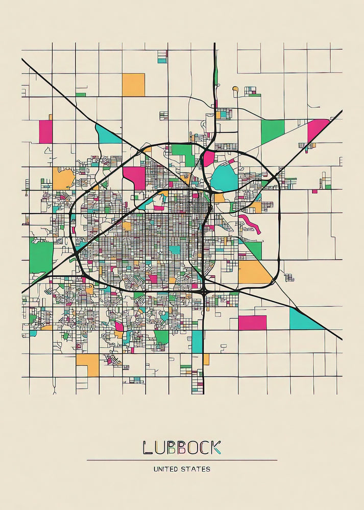
This Lubbock city map art print captures the urban layout of Lubbock, Texas, with a focus on its grid-like street patterns and key landmarks. Created in a modern cartographic style, it blends geographic accuracy with aesthetic clarity, making it ideal for those seeking a decorative yet informative piece. The map highlights neighborhoods, major roads, and points of interest, reflecting Lubbock's growth from a railroad town to a cultural hub on the South Plains.
Historical Context of Lubbock's Cartography
Lubbock's development, spurred by the railroad in the early 20th century, is mirrored in its orderly street grid. This map art print draws from historical surveys and contemporary GIS data, offering a snapshot of the city's evolution. It serves as a visual record of urban planning in West Texas, appealing to historians and residents alike.
Stylistic Analysis of the Map Design
The design employs clean lines, muted color palettes, and typographic hierarchy to enhance readability. Unlike traditional topographic maps, it emphasizes architectural and cultural landmarks, such as Texas Tech University and the Buddy Holly Center, using subtle iconography. This approach balances functionality with artistic minimalism, suitable for modern interiors.
Why Choose This Lubbock City Map Print
RedKalion's premium art prints ensure museum-quality reproduction, with attention to detail in every line and label. Our archival materials preserve the map's clarity and colors, making it a lasting addition to homes or offices. Trust our expertise in fine art printing for a piece that combines cartographic precision with decorative appeal.
Print Specifications & Materials
- Available Sizes: 75×100 cm / 30×40″, 40×50 cm / 16×20″, 21×29.7 cm / 8×12″
- Paper Finishing: Matte, uncoated, natural white (off-white)
- Acid-Free: pH above 7 to prevent yellowing over time
- Paper Weight: 250 gsm (110 lb) | Thickness: 0.29 mm (11.4 mils)
- Sustainable Paper: FSC-certified
This Lubbock city map art print offers a unique blend of history and design, perfect for enhancing any space with a touch of Texan heritage. Explore our collection for more curated cartographic works.


Discover Unlimited Art Possibilities
At RedKalion, you can find virtually any artwork from any artist, available in a wide range of sizes to perfectly match your space.
If you didn’t find what you’re looking for, contact us at support@redkalion.com . We will source any artwork and produce it in any size and format you need, including art prints, posters, canvas, framed pieces, framed canvas, and more.
For dedicated art enthusiasts, we also offer handcrafted replicas of any artwork, carefully painted by highly skilled artists using traditional techniques.
For custom requests, contact us at support@redkalion.com .
What landmarks are featured on this Lubbock city map art print?
This map includes Texas Tech University, the Buddy Holly Center, Mackenzie Park, and major highways like I-27, highlighting key cultural and architectural sites in Lubbock, Texas.
What paper is used for the Lubbock map fine art print?
We use FSC-certified, acid-free paper with a matte finish and 250 gsm weight, ensuring archival quality and durability for your Lubbock city map art print.
How is the Lubbock city map art print shipped?
Prints are shipped in sturdy tubes with protective packaging to prevent damage during transit, with tracking provided for all orders.
Will the Lubbock map print colors fade over time?
Our archival inks and acid-free paper resist fading and yellowing, preserving the Lubbock city map's details for decades under normal display conditions.
What sizes are available for this Lubbock city map print?
Available in 75×100 cm, 40×50 cm, and 21×29.7 cm, offering flexible options for framing and display in various spaces.
How does this map reflect Lubbock's historical development?
It shows the grid pattern from early 20th-century railroad expansion, illustrating Lubbock's growth from a small town to a major urban center in Texas.
What design elements make this map artistically unique?
The map uses minimalist iconography, muted colors, and clean typography to balance cartographic accuracy with modern aesthetic appeal for decorative purposes.